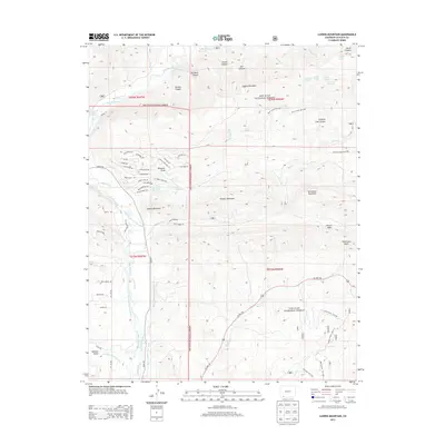
2013 Map of Ludwig Mountain
USGS Topo · Published 2013About this map
Ludwig Mountain and the surrounding peaks of the San Juan National Forest define this landscape east of the Los Pinos River valley. The 2013 survey illustrates a high-altitude terrain where water management is central to the land's utility, evidenced by the extensive network of irrigation features like the Bear Cr and Pine River Ditch, Wommer Ditch, and Thompson Epperson Ditch. These systems divert flow from the peaks toward the valley floor, supporting local agriculture and the residential development visible near Lake Simpatico.
Find a feature on this map
84 named features on this map. Tap any name to fly to it.
Don’t see what you’re looking for? This feature index may not catch every label — zoom into the map to look around manually.
Map Details
Editions of this 2013 Ludwig Mountain Map
This is the sole edition of this map. No revisions or reprints were ever made.
Other maps of this area

1908 · Ignacio
USGS Topo · 1:125,000

1924 · Ignacio
USGS Topo · 1:125,000

1924 · Pagosa Springs
USGS Topo · 1:125,000

1927 · Pagosa Springs
USGS Topo · 1:125,000

1945 · Durango
USGS Topo · 1:250,000

1953 · Durango
USGS Topo · 1:250,000

1954 · Durango
USGS Topo · 1:250,000

1961 · Durango
USGS Topo · 1:250,000

1963 · Durango
USGS Topo · 1:250,000
1964 · Baldy Mountain
USGS Topo · 1:24,000