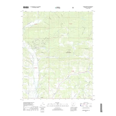
2019 Map of Ludwig Mountain
USGS Topo · Published 2019About this map
Bayfield serves as the southern anchor for this portion of La Plata County, where the high desert terrain meets the rising slopes of the San Juan National Forest. The landscape is defined by an intricate network of historical water management, featuring numerous man-made channels such as the Bear Creek and Pine River Ditch, Schroeder Ditch, and Thompson-Epperson Ditch that redirect the flow of the Los Pinos River to support local agriculture and development.
Find a feature on this map
94 named features on this map. Tap any name to fly to it.
Don’t see what you’re looking for? This feature index may not catch every label — zoom into the map to look around manually.
Map Details
Editions of this 2019 Ludwig Mountain Map
This is the sole edition of this map. No revisions or reprints were ever made.
Other maps of this area

1908 · Ignacio
USGS Topo · 1:125,000

1924 · Ignacio
USGS Topo · 1:125,000

1924 · Pagosa Springs
USGS Topo · 1:125,000

1927 · Pagosa Springs
USGS Topo · 1:125,000

1945 · Durango
USGS Topo · 1:250,000

1953 · Durango
USGS Topo · 1:250,000

1954 · Durango
USGS Topo · 1:250,000

1961 · Durango
USGS Topo · 1:250,000

1963 · Durango
USGS Topo · 1:250,000
1964 · Baldy Mountain
USGS Topo · 1:24,000