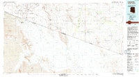
1994 Map of Lukeville
USGS Topo · Published 1994About this map
Organ Pipe Cactus National Monument dominates the western half of this 1994 survey, where the Lukeville Port of Entry marks the critical transition between the United States and Mexico. The international boundary splits the landscape, separating the Arizona settlement of Lukeville from its southern neighbor, Sonoyta, in the Estado de Sonora. East of the Ajo Range, the map reveals the cultural geography of the Papago Indian Reservation (Tohono O'odham Nation), featuring a network of traditional O'odham communities like Ali Chuk, Vamori, and Kom Vo. The drainage patterns of the Great Papago Plain are defined by numerous washes, including the Vamori Wash and Chukut Kuk Wash, which flow through the arid basins of the La Quituni Valley and Tecolote Valley.
Find a feature on this map
48 named features on this map. Tap any name to fly to it.
Don’t see what you’re looking for? This feature index may not catch every label — zoom into the map to look around manually.
Map Details
Editions of this 1994 Lukeville Map
This is the sole edition of this map. No revisions or reprints were ever made.
Other maps of this area

1934 · Silver Bell
USGS Topo · 1:125,000

1937 · Comobabi
USGS Topo · 1:48,000

1941 · Vamori
USGS Topo · 1:62,500

1941 · Sells
USGS Topo · 1:62,500

1942 · Comobabi
USGS Topo · 1:62,500

1943 · Sells
USGS Topo · 1:62,500

1943 · Fresnal
USGS Topo · 1:125,000

1943 · Vamori
USGS Topo · 1:62,500

1953 · Ajo
USGS Topo · 1:250,000

1954 · Sonoyta
USGS Topo · 1:250,000