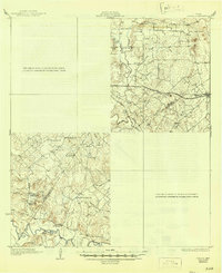
1929 Map of Luling
USGS Topo · Published 1946About this map
The Guadalupe River and San Marcos River dominate this Central Texas landscape, where the confluence of these waterways and the Southern Pacific railroad shaped early 20th-century commerce. In the mid-1920s, rural life centered around local hubs such as Harwood and Belmont, with a dense network of country schools including Union Center Sch and Dilworth Springs Sch. This survey uniquely integrates traditional topography with aerial photography provided by the Air Corps, U.S. Army, capturing the era's complex social landscape through sites like St James Tabernacle, Nixon Ch, and Nash Creek Methodist Ch. The terrain transitions from river valleys to high points like Iron Peak, with the boundary between Caldwell and Gonzales counties following the meandering path of the rivers and creeks like Plum Creek.
Find a feature on this map
29 named features on this map. Tap any name to fly to it.
Don’t see what you’re looking for? This feature index may not catch every label — zoom into the map to look around manually.
Map Details
Editions of this 1929 Luling Map
2 editions found
Other maps of this area

1901 · Flatonia
USGS Topo · 1:125,000

1911 · San Marcos
USGS Topo · 1:125,000

1919 · San Marcos
USGS Topo · 1:125,000

1920 · Smiley
USGS Topo · 1:125,000

1924 · San Marcos 3-d
USGS Topo · 1:48,000

1925 · San Marcos 4-c
USGS Topo · 1:48,000

1925 · San Marcos 1-d
USGS Topo · 1:48,000

1925 · San Marcos 4-a
USGS Topo · 1:48,000

1929 · Luling
USGS Topo · 1:62,500

1930 · Lockhart
USGS Topo · 1:62,500