
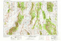
1956 Map of Lund
USGS Topo · Published 1963About this map
Humboldt National Forest dominates this mid-century survey of eastern Nevada and western Utah, where isolated agricultural settlements like Lund and Preston anchor the valleys between towering ranges. The map details a high-desert landscape defined by the White River and numerous springs that sustained the region’s early ranching and mining economy. To the south, the industrial presence of the Bristol Silver Mines and The Chief Mine near Pioche contrasts with the remote agricultural outposts of Sunnyside and Garrison. This era captures a transition in desert transport as the Grand Army of the Republic Highway traverses the terrain alongside older infrastructure like the Highline Road. From the Duckwater Indian Reservation in the west to the Snake Creek Cave near the Utah border, the map reveals a complex network of reservoirs, wells, and family-named ranches like Gardner Ranch and Sunnyside Whipple Ranch that mark the human imprint on this vast basin and range province.
Find a feature on this map
114 named features on this map. Tap any name to fly to it.
Don’t see what you’re looking for? This feature index may not catch every label — zoom into the map to look around manually.
Map Details
Editions of this 1956 Lund Map
2 editions found
Other maps of this area

1885 · St. George
USGS Topo · 1:250,000

1885 · Pioche
USGS Topo · 1:250,000

1886 · Pioche
USGS Topo · 1:250,000

1891 · St. George
USGS Topo · 1:250,000

1908 · Kawich
USGS Topo · 1:250,000

1908 · Fish Springs
USGS Topo · 1:250,000

1910 · Fish Springs
USGS Topo · 1:250,000

1915 · Bristol Range
USGS Topo · 1:62,500

1916 · Highland
USGS Topo · 1:62,500

1917 · Bristol Range
USGS Topo · 1:62,500