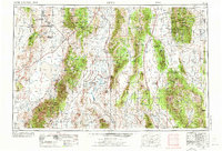
1956 Map of Lund
USGS Topo · Published 1972About this map
The Duckwater Indian Reservation and the remote ranching communities of the White River Valley define this mid-century portrait of east-central Nevada. Anchored by the settlements of Lund and Preston, the map illustrates a landscape of high desert basins and massive mountain ranges within the Humboldt National Forest. Industrial activity is noted through the Silver Belt Mine and Minerva Mine, along with an established Oil Field near Blue Eagle Mtn. The reliance on local hydrology is evident in the numerous charted water sources such as Blue Eagle Springs and Duck Water Spring. Farther east, the peaks of the Schell Creek Range rise above Baking Powder Flat, while the crumbling remains of Forest Home (Ruins) mark the site of an earlier occupation in the mountains.
Find a feature on this map
112 named features on this map. Tap any name to fly to it.
Don’t see what you’re looking for? This feature index may not catch every label — zoom into the map to look around manually.
Map Details
Editions of this 1956 Lund Map
2 editions found

Other maps of this area

1885 · St. George
USGS Topo · 1:250,000

1885 · Pioche
USGS Topo · 1:250,000

1886 · Pioche
USGS Topo · 1:250,000

1891 · St. George
USGS Topo · 1:250,000

1908 · Kawich
USGS Topo · 1:250,000

1908 · Fish Springs
USGS Topo · 1:250,000

1910 · Fish Springs
USGS Topo · 1:250,000

1915 · Bristol Range
USGS Topo · 1:62,500

1916 · Highland
USGS Topo · 1:62,500

1917 · Bristol Range
USGS Topo · 1:62,500