
1917 Map of Bristol Range
USGS Topo · Published 1917About this map
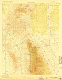
Mining operations and narrow-gauge rail transport define this high-altitude landscape in the Lincoln County backcountry. The map centers on the Bristol Range, where the Bristol Mines and Lucky Star Mine sit along the steep slopes. Of particular note to industrial historians is the Piocne Pacific Narrow Gage railroad, which skirts the eastern base of the mountains to serve the settlement of Jackrabbit. An Aerial Tram connects the high-elevation Jackrabbit Mine to the lower valley floor, illustrating the mechanical ingenuity required to extract silver and lead from these desert peaks.
Find a feature on this map
36 named features on this map. Tap any name to fly to it.
Don’t see what you’re looking for? This feature index may not catch every label — zoom into the map to look around manually.
Map Details
Editions of this 1917 Bristol Range Map
2 editions found
Other maps of this area

1885 · Pioche
USGS Topo · 1:250,000

1886 · Pioche
USGS Topo · 1:250,000

1915 · Bristol Range
USGS Topo · 1:62,500

1916 · Highland
USGS Topo · 1:62,500

1918 · Highland
USGS Topo · 1:62,500

1921 · NW 1/4 Panaca
USGS Topo · 1:48,000

1953 · Highland Peak
USGS Topo · 1:24,000

1953 · Bristol Range SE
USGS Topo · 1:24,000

1953 · Pioche
USGS Topo · 1:24,000

1954 · Caliente
USGS Topo · 1:250,000