
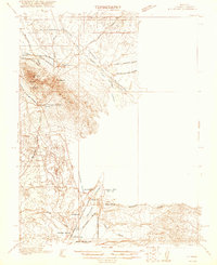
1921 Map of NW 1/4 Panaca
USGS Topo · Published 1921About this map
Mining operations and early railroad infrastructure dominate this 1916 survey of the high desert, captured during a period of industrial activity in the Ely Range. The town of Pioche serves as the focal point for regional silver and lead extraction, with the Prince Consolidated Mine and the Prince Con Mining and Smelting Co illustrating the era's heavy industrial footprint. Transporting ore from these sites required specialized transit, shown here as the Pacific (Narrow Gauge) and the Caliente and Pioche Branch, which connect the highland mines to processing points near Bullionville.
Find a feature on this map
34 named features on this map. Tap any name to fly to it.
Don’t see what you’re looking for? This feature index may not catch every label — zoom into the map to look around manually.
Map Details
Editions of this 1921 NW 1/4 Panaca Map
2 editions found
Other maps of this area

1885 · Pioche
USGS Topo · 1:250,000

1886 · Pioche
USGS Topo · 1:250,000

1915 · Bristol Range
USGS Topo · 1:62,500

1916 · Highland
USGS Topo · 1:62,500

1917 · Bristol Range
USGS Topo · 1:62,500

1918 · Highland
USGS Topo · 1:62,500

1953 · Highland Peak
USGS Topo · 1:24,000

1953 · Bristol Range SE
USGS Topo · 1:24,000

1953 · Pioche
USGS Topo · 1:24,000

1954 · Caliente
USGS Topo · 1:250,000