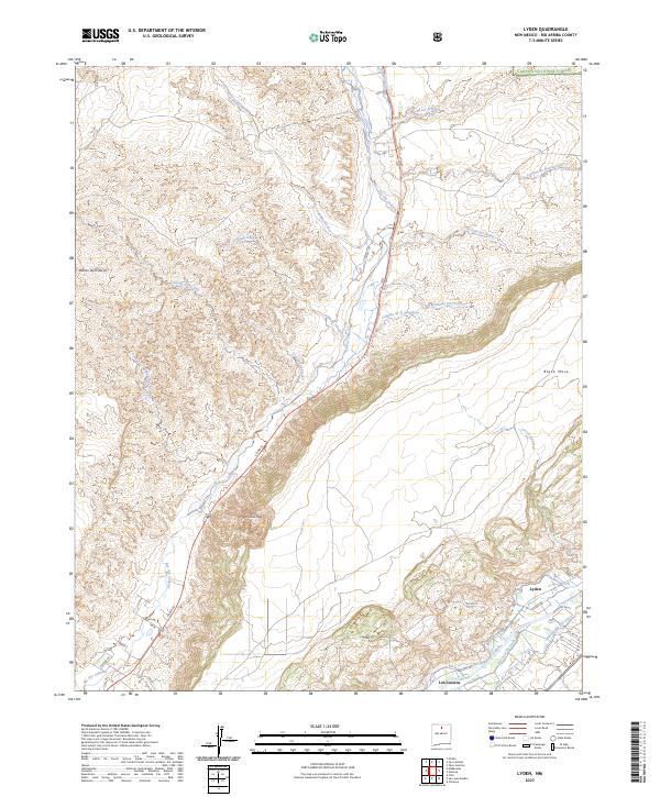
2023 Map of Lyden
USGS Topo · Published 2023About this map
The confluence of the Rio Grande and Rio Ojo Caliente defines the hydraulic character of this Rio Arriba County landscape. In the southeastern corner, the settlement of Lyden is intricately connected to a network of traditional water management features, including the La Mesa Ditch, El Medio Ditch, and Rinconada Isla Ditch. These waterways reflect the historical reliance on acequia systems for agriculture along the river valley. To the north, the terrain rises toward the southern reaches of the Carson National Forest, marked by numerous arroyos and canyons such as Arroyo del Pueblo and Canada de la Cruz. Dominant topographical landmarks like Black Mesa and Vallito Peak stand above the drainage basins. Further south, the community of Los Luceros sits near the Los Luceros Ditch, illustrating the persistent patterns of valley settlement adjacent to fertile riparian corridors.
Find a feature on this map
36 named features on this map. Tap any name to fly to it.
Don’t see what you’re looking for? This feature index may not catch every label — zoom into the map to look around manually.
Map Details
Editions of this 2023 Lyden Map
This is the sole edition of this map. No revisions or reprints were ever made.
Other maps of this area

1918 · Abiquiu
USGS Topo · 1:125,000

1953 · Chili
USGS Topo · 1:24,000

1953 · Medanales
USGS Topo · 1:24,000

1953 · San Juan Pueblo
USGS Topo · 1:24,000

1953 · Lyden
USGS Topo · 1:24,000

1953 · Velarde
USGS Topo · 1:24,000

1953 · El Rito
USGS Topo · 1:24,000

1953 · Chimayo
USGS Topo · 1:24,000

1953 · Ojo Caliente
USGS Topo · 1:24,000

1953 · San Juan Pueblo
USGS Topo · 1:62,500