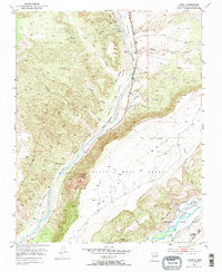
1953 Map of Lyden
USGS Topo · Published 1968About this map
Rio Ojo Caliente snakes through a landscape defined by ancestral Spanish land grants and desert canyons in the early 1950s. The convergence of the Antonio De Abeyta Grant Boundary and the Black Mesa Grant highlights the region's complex land tenure history, where the expansive Black Mesa and Vallito Peak tower over the valley floors. Agriculture and irrigation are central to life here, evidenced by a network of waterways including the Gavilan Ditch and labels for El Medio and Los Luceros along the bottomland.
Find a feature on this map
32 named features on this map. Tap any name to fly to it.
Don’t see what you’re looking for? This feature index may not catch every label — zoom into the map to look around manually.
Map Details
Editions of this 1953 Lyden Map
2 editions found
Other maps of this area

1918 · Abiquiu
USGS Topo · 1:125,000

1953 · Chili
USGS Topo · 1:24,000

1953 · Medanales
USGS Topo · 1:24,000

1953 · San Juan Pueblo
USGS Topo · 1:24,000

1953 · Lyden
USGS Topo · 1:24,000

1953 · Velarde
USGS Topo · 1:24,000

1953 · El Rito
USGS Topo · 1:24,000

1953 · Chimayo
USGS Topo · 1:24,000

1953 · Ojo Caliente
USGS Topo · 1:24,000

1953 · San Juan Pueblo
USGS Topo · 1:62,500