
1953 Map of Lyden
USGS Topo · Published 1954About this map
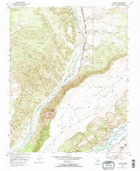
Black Mesa Grant dominates this landscape in Rio Arriba County, defined by the convergence of the Rio Ojo Caliente and the Rio Grande. The settlement of Lyden sits tucked against the valley floor, where an intricate network of irrigation is evidenced by various labels for Ditch. The map illustrates a transitional geography between the flat-topped Black Mesa and the dissected canyonlands to the north, including Cañada del Cuervo and Cañada Ancha. Cultural landmarks of the early 1950s are preserved here, such as the Torreon Indian Shop along the Kit Carson Highway. Significant land grant divisions are clearly delineated, tracing the historical property lines of the Antonio De Abeyta Grant Boundary and the Sebastian Martin Grant Boundary, which provide essential context for understanding the region's colonial and territorial era property patterns.
Find a feature on this map
31 named features on this map. Tap any name to fly to it.
Don’t see what you’re looking for? This feature index may not catch every label — zoom into the map to look around manually.
Map Details
Editions of this 1953 Lyden Map
2 editions found
Other maps of this area

1918 · Abiquiu
USGS Topo · 1:125,000

1953 · Chili
USGS Topo · 1:24,000

1953 · Medanales
USGS Topo · 1:24,000

1953 · San Juan Pueblo
USGS Topo · 1:24,000

1953 · Velarde
USGS Topo · 1:24,000

1953 · El Rito
USGS Topo · 1:24,000

1953 · Chimayo
USGS Topo · 1:24,000

1953 · Ojo Caliente
USGS Topo · 1:24,000

1953 · San Juan Pueblo
USGS Topo · 1:62,500

1954 · Raton
USGS Topo · 1:250,000