2024 Map of Lyerly
USGS Topo · Published 2024About this map
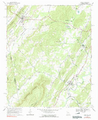
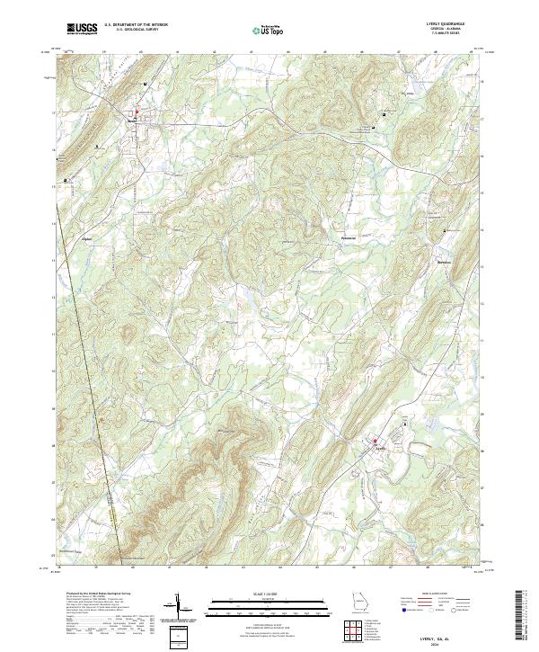
The Chattooga River winds through the southeastern corner of this landscape, anchoring the town of Lyerly where the valley floor widens. This Chattooga County terrain is defined by parallel ridges and valleys, including the prominent Shinbone Ridge and Shinbone Valley to the northwest, and Dirtsetter Mtn rising in the center. The mapping shows a distributed network of early rural settlements such as Alpine and Berryton, each with its own local history preserved through sites like Berryton Cem and Ami Cem.
Find a feature on this map
108 named features on this map. Tap any name to fly to it.
Don’t see what you’re looking for? This feature index may not catch every label — zoom into the map to look around manually.
Map Details
Editions of this 2024 Lyerly Map
This is the sole edition of this map. No revisions or reprints were ever made.