2023 Map of Lykens
USGS Topo · Published 2023About this map
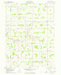
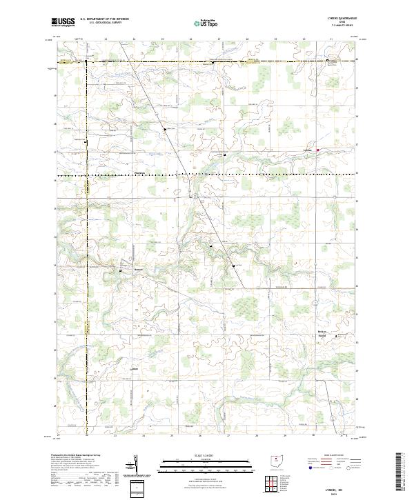
The agrarian landscape of northwest Crawford County is defined by a dense network of township roads and small, scattered settlements like Lykens and Benton. This survey illustrates the intricate drainage patterns of the region, where Sycamore Creek and Greasy Run meander through the flat till plains toward the Sandusky River basin. The geography is deeply rooted in the Public Land Survey System, with township and range lines like t1s r15e clearly demarcating the straight-line borders that characterize the Ohio countryside.
Find a feature on this map
72 named features on this map. Tap any name to fly to it.
Don’t see what you’re looking for? This feature index may not catch every label — zoom into the map to look around manually.
Map Details
Editions of this 2023 Lykens Map
This is the sole edition of this map. No revisions or reprints were ever made.