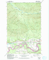
1980 Map of Lyman
USGS Topo · Published 1994About this map
Lyman and the neighboring settlement of Hamilton occupy the flat Skagit River Valley in this 1980s-era topographical record. The landscape is defined by the braided path of the Skagit Wild and Scenic River, where side channels like Jims Slough and Davis Slough weave through the bottomlands. To the north, the terrain rises sharply into the high timber and rocky peaks of Lyman Hill and Miner Mountain, separated by the remote Lyman Pass. This transition from the industrial and residential corridor along the valley floor to the steep drainages of Roaring Creek and Cavanaugh Creek illustrates the geographical constraints on development in the region. Local history is evidenced by the Lyman Ferry (Site) and the Hamilton Cemetery, marking earlier modes of river crossing and long-standing community centers.
Find a feature on this map
44 named features on this map. Tap any name to fly to it.
Don’t see what you’re looking for? This feature index may not catch every label — zoom into the map to look around manually.
Map Details
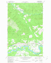
Editions of this 1980 Lyman Map
2 editions found
Other maps of this area

1899 · Stillaguamish
USGS Topo · 1:125,000

1901 · Stilaguamish
USGS Topo · 1:125,000

1909 · Mt Baker
USGS Topo · 1:192,000

1911 · Mount Vernon
USGS Topo · 1:125,000

1915 · Mt. Baker
USGS Topo · 1:250,000

1921 · Wickersham
USGS Topo · 1:62,500

1944 · Clear Lake
USGS Topo · 1:62,500

1951 · Wickersham
USGS Topo · 1:62,500

1952 · Hamilton
USGS Topo · 1:62,500

1955 · Concrete
USGS Topo · 1:250,000