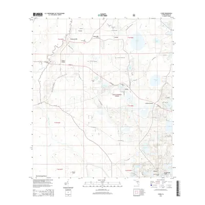
2015 Map of Lynne
USGS Topo · Published 2015About this map
Ocala National Forest dominates the central and eastern portions of this Marion County map, where the pine flatwoods and oak hammocks are punctuated by a dense network of freshwater lakes. Along the western edge, the Ocklawaha River and its tributary, the Dead River, snake through the lowlands near Silver Springs Shores, creating a complex wetland environment. These waterways have long shaped the settlement patterns of the region, from the early river-crossing at Ocklawaha Bridge Cem to the established communities of Bruceville and Lynne.
Find a feature on this map
68 named features on this map. Tap any name to fly to it.
Don’t see what you’re looking for? This feature index may not catch every label — zoom into the map to look around manually.
Map Details
Editions of this 2015 Lynne Map
This is the sole edition of this map. No revisions or reprints were ever made.
Other maps of this area

1893 · Citra
USGS Topo · 1:62,500

1895 · Citra
USGS Topo · 1:62,500

1895 · Ocala
USGS Topo · 1:62,500

1954 · Gainesville
USGS Topo · 1:250,000

1954 · Daytona Beach
USGS Topo · 1:250,000

1958 · Daytona Beach
USGS Topo · 1:250,000

1958 · Gainesville
USGS Topo · 1:250,000

1959 · Gainesville
USGS Topo · 1:250,000

1964 · Daytona Beach
USGS Topo · 1:250,000
1967 · Ocala East
USGS Topo · 1:24,000