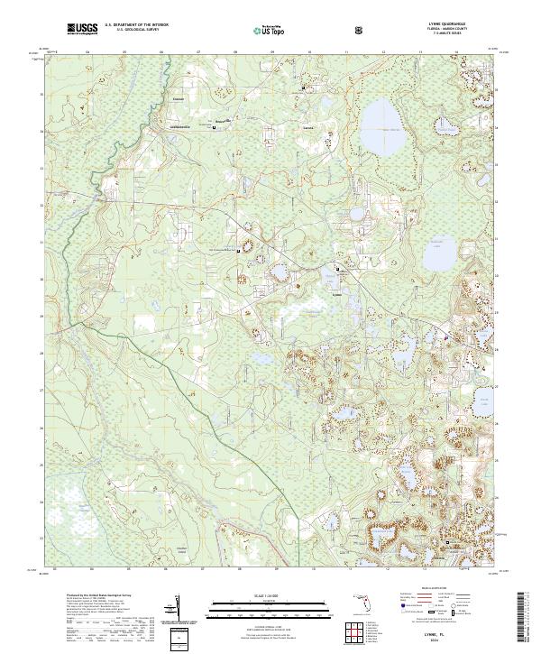
2024 Map of Lynne
USGS Topo · Published 2024About this map
Ocklawaha River winds through the western portion of this Marion County landscape, defining a network of wetlands and low-lying reaches including Marshall Swamp and Heather Island. The settlement pattern is characterized by small, dispersed communities such as Lynne, Grahamsville, and Electra, which are connected by historic roadways and the Florida National Scenic Trl. For local historians and genealogists, the map identifies several significant burial sites, including the Old Grahamsville Cem, Gore Family Cem, and the Ocklawaha Bridge Cem. The geography is defined by numerous isolated basins and prairies, such as Church Lake Prairie and Bream Lake, reflecting the complex karst-influenced hydrography of north-central Florida. To the south, the Ocklawaha Prairie Restoration Area Trl highlights modern conservation efforts within this historically settled area, while the Woods and Lakes Airpark near Electra indicates more contemporary infrastructure.
Find a feature on this map
39 named features on this map. Tap any name to fly to it.
Don’t see what you’re looking for? This feature index may not catch every label — zoom into the map to look around manually.
Map Details
Editions of this 2024 Lynne Map
This is the sole edition of this map. No revisions or reprints were ever made.
Other maps of this area

1893 · Citra
USGS Topo · 1:62,500

1895 · Citra
USGS Topo · 1:62,500

1895 · Ocala
USGS Topo · 1:62,500

1954 · Gainesville
USGS Topo · 1:250,000

1954 · Daytona Beach
USGS Topo · 1:250,000

1958 · Daytona Beach
USGS Topo · 1:250,000

1958 · Gainesville
USGS Topo · 1:250,000

1959 · Gainesville
USGS Topo · 1:250,000

1964 · Daytona Beach
USGS Topo · 1:250,000
1967 · Ocala East
USGS Topo · 1:24,000