2024 Map of Lynnville
USGS Topo · Published 2024About this map
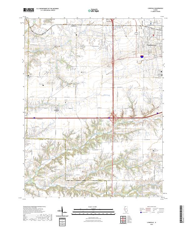
Lynnville and the western edge of Jacksonville anchor this landscape, where the flat agricultural plains of Morgan County meet the more intricate drainage systems of the Big Sandy Creek valley. The map reveals a dense network of local cemeteries, including Lynnville Cem, Richardson Cem, and the historic Diamond Grove Cem, which serve as vital markers for genealogical research in this region. The terrain is notably interrupted by prominent elevations such as Allison Mound and The Mound, which stand as landmarks above the surrounding creek bottoms.
Find a feature on this map
86 named features on this map. Tap any name to fly to it.
Don’t see what you’re looking for? This feature index may not catch every label — zoom into the map to look around manually.
Map Details
Editions of this 2024 Lynnville Map
This is the sole edition of this map. No revisions or reprints were ever made.