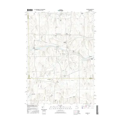
2016 Map of Macedon
USGS Topo · Published 2016About this map
The Erie Canal and Ganargua Creek define the central corridor of this Western New York landscape, tracing a path through the village of Macedon and the surrounding agricultural uplands. This area, spanning the borders of Monroe, Wayne, and Ontario counties, reveals a dense network of local history through its numerous burial grounds, such as Saint Patricks Cem and the North Farmington Friends Cem. The landscape is punctuated by several small airstrips, including Harvs Airport and Lakestone Farm Airport, suggesting a legacy of private aviation amidst the farm fields.
Find a feature on this map
94 named features on this map. Tap any name to fly to it.
Don’t see what you’re looking for? This feature index may not catch every label — zoom into the map to look around manually.
Map Details
Editions of this 2016 Macedon Map
This is the sole edition of this map. No revisions or reprints were ever made.
Other maps of this area

1899 · Palmyra
USGS Topo · 1:62,500

1900 · Macedon
USGS Topo · 1:62,500

1900 · Canandaigua
USGS Topo · 1:62,500

1902 · Phelps
USGS Topo · 1:62,500

1902 · Palmyra
USGS Topo · 1:62,500

1903 · Canandaigua
USGS Topo · 1:62,500

1932 · Webster
USGS Topo · 1:24,000

1932 · Fairport
USGS Topo · 1:24,000

1934 · Fairport
USGS Topo · 1:24,000

1934 · Webster
USGS Topo · 1:24,000