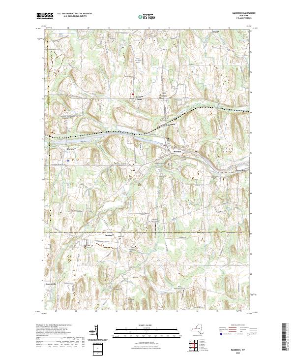
2023 Map of Macedon
USGS Topo · Published 2023About this map
The Erie Canal cuts through this Wayne County landscape, serving as a historic anchor for settlements like Macedon and Wayneport. The map reveals a high density of small-scale aviation and agricultural heritage, with several private landing strips such as Harvs Airport, Long Acre Farms Airport, and the New Salem Aerodrome scattered among the drumlins and creek valleys. These topographical features, including Science Hill and Dynamite Hill, influence the winding path of Ganargua Creek as it meanders toward Yellow Mills.
Find a feature on this map
93 named features on this map. Tap any name to fly to it.
Don’t see what you’re looking for? This feature index may not catch every label — zoom into the map to look around manually.
Map Details
Editions of this 2023 Macedon Map
This is the sole edition of this map. No revisions or reprints were ever made.
Other maps of this area

1899 · Palmyra
USGS Topo · 1:62,500

1900 · Macedon
USGS Topo · 1:62,500

1900 · Canandaigua
USGS Topo · 1:62,500

1902 · Phelps
USGS Topo · 1:62,500

1902 · Palmyra
USGS Topo · 1:62,500

1903 · Canandaigua
USGS Topo · 1:62,500

1932 · Webster
USGS Topo · 1:24,000

1932 · Fairport
USGS Topo · 1:24,000

1934 · Fairport
USGS Topo · 1:24,000

1934 · Webster
USGS Topo · 1:24,000