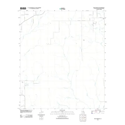
2012 Map of Mach Branch
USGS Topo · Published 2012About this map
Tulla and its surrounding parish lands are defined by a complex network of small waterways and family-named roads in this 2012 survey. The landscape is carved by numerous small branches and gullies, including the centrally located Hickory Br and the namesake Mach Br. To the east, the terrain follows the course of Mayhaw Br and Middle Br, while the western portion is marked by features like Wildcat Br and Cowpen Cr. Local history is anchored by the Bishop Cem and Havens Cem, located near Beehive Loop. The road network, including Mennonite Rd and Russell Havens Rd, suggests a pattern of rural residency and agriculture that relies on these numerous natural drainages like Hop Gully and Sheep Pen Gully.
Find a feature on this map
44 named features on this map. Tap any name to fly to it.
Don’t see what you’re looking for? This feature index may not catch every label — zoom into the map to look around manually.
Map Details
Editions of this 2012 Mach Branch Map
This is the sole edition of this map. No revisions or reprints were ever made.
Other maps of this area

1935 · Longville
USGS Topo · 1:31,680

1947 · Singer
USGS Topo · 1:31,680

1947 · Pujo
USGS Topo · 1:31,680

1947 · Oretta
USGS Topo · 1:31,680

1947 · DeRidder
USGS Topo · 1:31,680

1947 · Kernan
USGS Topo · 1:31,680

1947 · Ikes
USGS Topo · 1:31,680

1947 · Longville
USGS Topo · 1:31,680

1947 · Beckwith School
USGS Topo · 1:31,680

1947 · Bannister
USGS Topo · 1:31,680