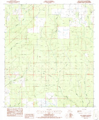
1986 Map of Mach Branch
USGS Topo · Published 1986About this map
Tulla and the surrounding drainage basins of Beauregard Parish are defined by a complex network of waterways and early industrial agriculture during the mid-1980s. The landscape is characterized by its creek systems, including Wild Cow Creek, Mach Branch, and Cole Creek, which feed into the broader basin. Evidence of the region's agricultural transition is seen in the presence of Rice Field installations and a Well Siphon near Pin Oak Flat, indicating localized irrigation efforts.
Find a feature on this map
29 named features on this map. Tap any name to fly to it.
Don’t see what you’re looking for? This feature index may not catch every label — zoom into the map to look around manually.
Map Details
Editions of this 1986 Mach Branch Map
This is the sole edition of this map. No revisions or reprints were ever made.
Other maps of this area

1935 · Longville
USGS Topo · 1:31,680

1947 · Singer
USGS Topo · 1:31,680

1947 · Pujo
USGS Topo · 1:31,680

1947 · Oretta
USGS Topo · 1:31,680

1947 · DeRidder
USGS Topo · 1:31,680

1947 · Kernan
USGS Topo · 1:31,680

1947 · Ikes
USGS Topo · 1:31,680

1947 · Longville
USGS Topo · 1:31,680

1947 · Beckwith School
USGS Topo · 1:31,680

1947 · Bannister
USGS Topo · 1:31,680