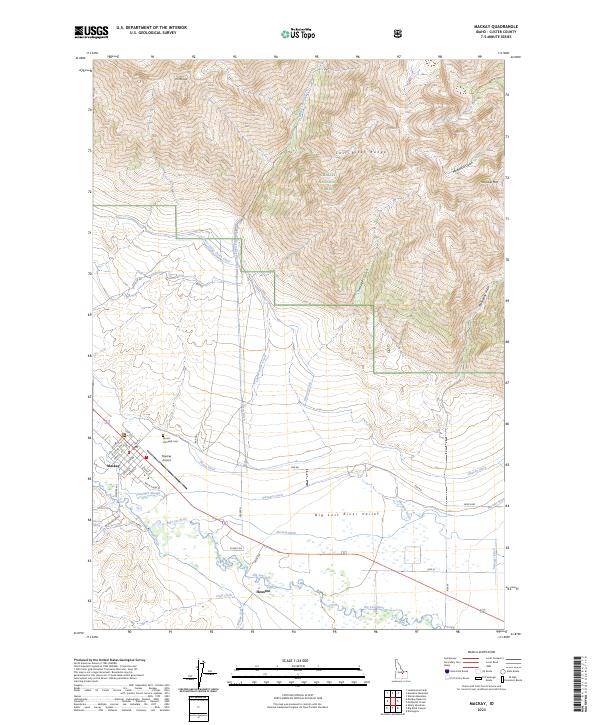
2023 Map of Mackay
USGS Topo · Published 2023About this map
Mt McCaleb towers over the northern landscape of the Lost River Range, overlooking a valley floor defined by an intricate network of irrigation channels. The town of Mackay serves as the local hub, situated just west of the Mackay Airport and the Mount McCaleb Cem. This region's agricultural and ranching history is etched into the terrain through named waterways like Lower Cedar Creek Ditch, Swauger Ditch, and Burnett Ditch, which redirect the Big Lost River across the Big Lost River Valley.
Find a feature on this map
52 named features on this map. Tap any name to fly to it.
Don’t see what you’re looking for? This feature index may not catch every label — zoom into the map to look around manually.
Map Details
Editions of this 2023 Mackay Map
This is the sole edition of this map. No revisions or reprints were ever made.
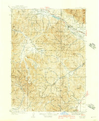
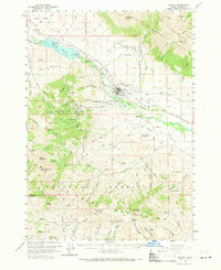
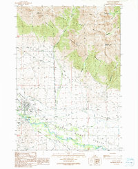
Historical Maps of Mackay Through Time
4 maps found