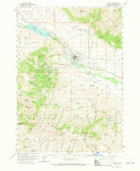
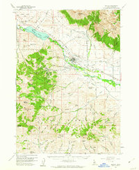
1960 Map of Mackay
USGS Topo · Published 1971About this map
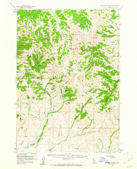
Mackay serves as the central hub of this Custer County landscape, situated along the Big Lost River just south of the Mackay Dam and its accompanying Mackay Reservoir. The map illustrates a region transitioning from its early mining peaks toward a mid-century economy, where the industrial legacy of the White Knob Mountains is visible through numerous workings like the Empire Mine and Horseshoe Mine. The presence of the Empire Smelter (Site) and Mammoth (Site) indicates the scale of previous operations, while the Union Pacific railroad line connects these mountain resources to the wider valley floor. Genealogy and local history are preserved in the locations of Battleground Cem, Mt McCaleb Cem, and the settlement of Houston, providing a clear view of the area's social and physical geography during the 1960 survey period.
Find a feature on this map
95 named features on this map. Tap any name to fly to it.
Don’t see what you’re looking for? This feature index may not catch every label — zoom into the map to look around manually.
Map Details
Editions of this 1960 Mackay Map
2 editions found
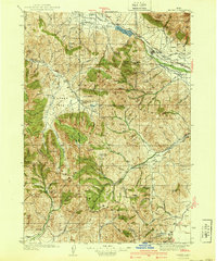
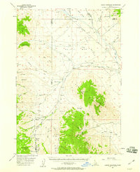
Other maps of this area

1935 · MacKay
USGS Topo · 1:96,000

1935 · Borah Peak
USGS Topo · 1:125,000

1938 · Borah Peak
USGS Topo · 1:125,000
1940 · Mackay
USGS Topo · 1:62,500

1955 · Dubois
USGS Topo · 1:250,000

1955 · Idaho Falls
USGS Topo · 1:250,000
1957 · Hawley Mountain
USGS Topo · 1:62,500

1958 · Dubois
USGS Topo · 1:250,000

1958 · Idaho Falls
USGS Topo · 1:250,000
1960 · Muldoon Canyon
USGS Topo · 1:62,500