
1935 Map of Borah Peak
USGS Topo · Published 1959About this map
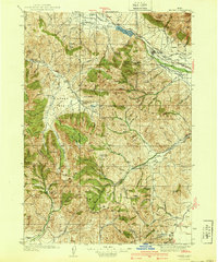
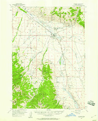
Borah Peak stands as the dramatic centerpiece of this mid-1930s survey, marking the high point of a landscape defined by the drainage systems of the Pahsimeroi River and the Big Lost River. The map captures a high-desert and alpine transition where ranching and forestry dictated the settlement patterns of central Idaho. Scattered outposts such as the Doublespring Ranch and Elkhorn Ranch appear alongside remote community hubs like Goldburg Sch and Big Creek Sch, illustrating the reach of rural education in this period.
Find a feature on this map
82 named features on this map. Tap any name to fly to it.
Don’t see what you’re looking for? This feature index may not catch every label — zoom into the map to look around manually.
Map Details
Editions of this 1935 Borah Peak Map
This is the sole edition of this map. No revisions or reprints were ever made.
Other maps of this area

1895 · Hailey
USGS Topo · 1:125,000

1897 · Hailey
USGS Topo · 1:125,000

1929 · Bayhorse
USGS Topo · 1:125,000

1935 · MacKay
USGS Topo · 1:96,000

1938 · Borah Peak
USGS Topo · 1:125,000
1940 · Mackay
USGS Topo · 1:62,500

1955 · Dubois
USGS Topo · 1:250,000

1955 · Idaho Falls
USGS Topo · 1:250,000

1955 · Hailey
USGS Topo · 1:250,000
1956 · Leadore
USGS Topo · 1:62,500