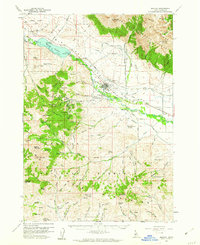
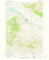
1960 Map of Mackay
USGS Topo · Published 1962About this map
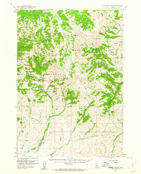
Mackay serves as the focal point of this 1960 survey, situated at the base of the massive White Knob Mountains within the Challis National Forest. The local economy of the mid-20th century is clearly etched into the landscape through the extensive mining operations found in the mountains to the west, including the Empire Mine, Horseshoe Mine, and the Cossack Tunnel. The Big Lost River dominates the valley floor, regulated by the Mackay Dam and fueling an intricate network of irrigation such as the Nielson Ditch and Swauger Ditch.
Find a feature on this map
60 named features on this map. Tap any name to fly to it.
Don’t see what you’re looking for? This feature index may not catch every label — zoom into the map to look around manually.
Map Details
Editions of this 1960 Mackay Map
2 editions found
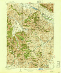
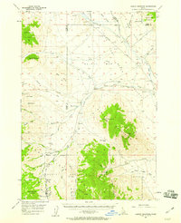
Other maps of this area

1935 · MacKay
USGS Topo · 1:96,000

1935 · Borah Peak
USGS Topo · 1:125,000

1938 · Borah Peak
USGS Topo · 1:125,000
1940 · Mackay
USGS Topo · 1:62,500

1955 · Dubois
USGS Topo · 1:250,000

1955 · Idaho Falls
USGS Topo · 1:250,000
1957 · Hawley Mountain
USGS Topo · 1:62,500

1958 · Dubois
USGS Topo · 1:250,000

1958 · Idaho Falls
USGS Topo · 1:250,000
1960 · Muldoon Canyon
USGS Topo · 1:62,500