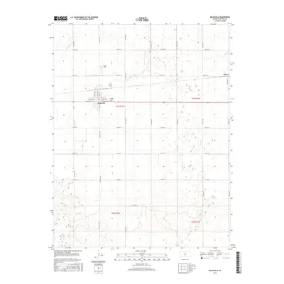
2015 Map of Macksville
USGS Topo · Published 2015About this map
Macksville stands as a central hub in this section of Stafford County, where the grid of agricultural roads meets the local rail line. The landscape is defined by its gradual drainage patterns, with Wild Horse Cr and Little Wild Horse Cr meandering through the northwest, while Spring Cr and Bear Cr drain the eastern reaches. Local history is anchored by sites like the Township Cemetery just east of the main town center and Smith Field to the north. Smaller locales such as Dillwyn appear along the eastern border, illustrating the distribution of prairie settlements in the early 21st century. The map provides a detailed view of the town's street plan, naming thoroughfares like West Broadway Street and North Main Street, reflecting the organized layout of this Kansas farming community.
Find a feature on this map
40 named features on this map. Tap any name to fly to it.
Don’t see what you’re looking for? This feature index may not catch every label — zoom into the map to look around manually.
Map Details
Editions of this 2015 Macksville Map
This is the sole edition of this map. No revisions or reprints were ever made.
Other maps of this area

1889 · Larned
USGS Topo · 1:125,000

1889 · Kinsley
USGS Topo · 1:125,000

1891 · Great Bend
USGS Topo · 1:125,000

1891 · Larned
USGS Topo · 1:125,000

1892 · Kinsley
USGS Topo · 1:125,000

1892 · Pratt
USGS Topo · 1:125,000

1893 · Great Bend
USGS Topo · 1:125,000

1894 · Kinsley
USGS Topo · 1:125,000

1894 · Pratt
USGS Topo · 1:125,000

1955 · Great Bend
USGS Topo · 1:250,000