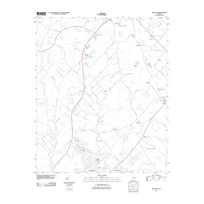
2011 Map of Macon NE
USGS Topo · Published 2011About this map
Clinton and Morton anchor the northern reaches of this Georgia landscape, which is defined by a dense network of residential developments and agricultural holdings east of Macon. The area is notable for its numerous family and community burial grounds, including the Walker - Pitts Cemetery, Henderson Stripling Cemetery, and Wincey Cemetery, reflecting the long-standing genealogical roots of this part of Bibb County. Water management is a central feature of the terrain, with dozens of named impoundments such as Lake Tonowanda, Newberry Lake, and Ethridge Lake situated along the many branches of Sand Creek, Rock Creek, and Dry Bone Creek. In the southern portion of the sheet, suburban expansion is evident in neighborhoods like Kings View and Bowden Hills, which sit adjacent to the Middle Georgia Memorial Gardens. The infrastructure here shows a transition from rural roads to more modern thoroughfares like Old Macon Rd and Griswoldville Rd.
Find a feature on this map
109 named features on this map. Tap any name to fly to it.
Don’t see what you’re looking for? This feature index may not catch every label — zoom into the map to look around manually.
Map Details
Editions of this 2011 Macon NE Map
This is the sole edition of this map. No revisions or reprints were ever made.
Other maps of this area

1953 · Athens
USGS Topo · 1:250,000

1956 · Gordon
USGS Topo · 1:62,500

1956 · Macon West
USGS Topo · 1:24,000

1956 · Macon East
USGS Topo · 1:24,000

1956 · Macon
USGS Topo · 1:62,500

1957 · Macon
USGS Topo · 1:250,000

1958 · Macon
USGS Topo · 1:250,000

1958 · Athens
USGS Topo · 1:250,000

1959 · Athens
USGS Topo · 1:250,000

1963 · Athens
USGS Topo · 1:250,000