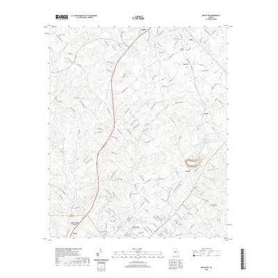
2020 Map of Macon NE
USGS Topo · Published 2020About this map
The boundary between Jones Co and Bibb Co serves as a central axis for this landscape, where the northern reach of Macon transitions into rural terrain. The area is defined by a series of small water bodies and creek systems, including Dry Bone Creek, Walnut Creek, and Sand Cr. These waterways are flanked by numerous family-named cemeteries, such as the Walker-Pitts Cem and Henderson-Stripling Cem, which offer significant value for genealogists tracing local lineage in central Georgia.
Find a feature on this map
167 named features on this map. Tap any name to fly to it.
Don’t see what you’re looking for? This feature index may not catch every label — zoom into the map to look around manually.
Map Details
Editions of this 2020 Macon NE Map
This is the sole edition of this map. No revisions or reprints were ever made.
Other maps of this area

1953 · Athens
USGS Topo · 1:250,000

1956 · Gordon
USGS Topo · 1:62,500

1956 · Macon West
USGS Topo · 1:24,000

1956 · Macon East
USGS Topo · 1:24,000

1956 · Macon
USGS Topo · 1:62,500

1957 · Macon
USGS Topo · 1:250,000

1958 · Macon
USGS Topo · 1:250,000

1958 · Athens
USGS Topo · 1:250,000

1959 · Athens
USGS Topo · 1:250,000

1963 · Athens
USGS Topo · 1:250,000