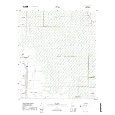
2018 Map of Madewood
USGS Topo · Published 2018About this map
Bayou Lafourche anchors this part of Assumption Parish, where the land and local identity are defined by its winding course and the historical sugar plantation names that persist as modern settlements. Communities like Madewood, Rosedale, and Woodlawn line the roads following the waterway, while the surrounding landscape is a complex network of drainage and transport routes, including the Baker Canal East and Baker Canal North. To the east, the terrain transitions into the dense wetlands of the lower Mississippi Delta, marked by Bayou Verret and Bayou Traverse. This geography illustrates the century-old transition from agricultural estates to contemporary rural residences, where parish lines between Assumption, St. James, and Lafourche intersect among the marshes. Researchers will find a clear record of local infrastructure, from the HWY 1009 corridor to the intricate systems of smaller thoroughfares like Ingleside RD and Albermarle RD.
Find a feature on this map
46 named features on this map. Tap any name to fly to it.
Don’t see what you’re looking for? This feature index may not catch every label — zoom into the map to look around manually.
Map Details
Editions of this 2018 Madewood Map
This is the sole edition of this map. No revisions or reprints were ever made.
Other maps of this area

1892 · Donaldsonville
USGS Topo · 1:62,500

1892 · Thibodaux
USGS Topo · 1:62,500

1927 · Thibodaux NW
USGS Topo · 1:31,680

1932 · Thibodaux NE
USGS Topo · 1:31,680

1932 · Thibodaux SE
USGS Topo · 1:31,680

1932 · Thibodaux SW
USGS Topo · 1:31,680

1936 · White Castle
USGS Topo · 1:62,500

1938 · Labadieville
USGS Topo · 1:24,000
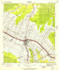
1938 · Lafourche
USGS Topo · 1:24,000

1939 · Donaldsonville
USGS Topo · 1:62,500