
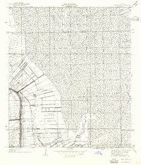
1940 Map of Madewood
USGS Topo · Published 1940About this map
Bayou Lafourche anchors this 1938 survey of the Louisiana sugar belt, where the land's transition from cultivated levee strips to dense swamp is clearly defined. The settlement pattern follows the high ground of the bayou, featuring a string of communities and estates including Madewood, Elmfield, Ingleside, and Albemarle. Beyond the narrow agricultural corridor, the terrain gives way to the wetlands of the Assumption and St. James Parish border, a landscape dominated by drainage features like Bayou Verretti and Coteau Frene. The infrastructure of the era is evident in the Texas and Pacific Railroad and the specialized narrow gage lines and old logging railroads that once pushed deep into the backswamps. Rural life is marked by local landmarks such as Woodlawn Ch and Mt Carmel Ch, which served these tightly clustered riverfront communities.
Find a feature on this map
30 named features on this map. Tap any name to fly to it.
Don’t see what you’re looking for? This feature index may not catch every label — zoom into the map to look around manually.
Map Details
Editions of this 1940 Madewood Map
2 editions found
Other maps of this area

1892 · Donaldsonville
USGS Topo · 1:62,500

1892 · Thibodaux
USGS Topo · 1:62,500

1927 · Thibodaux NW
USGS Topo · 1:31,680

1932 · Thibodaux NE
USGS Topo · 1:31,680

1932 · Thibodaux SE
USGS Topo · 1:31,680

1932 · Thibodaux SW
USGS Topo · 1:31,680

1936 · White Castle
USGS Topo · 1:62,500

1938 · Labadieville
USGS Topo · 1:24,000
1938 · Lafourche
USGS Topo · 1:24,000

1939 · Donaldsonville
USGS Topo · 1:62,500