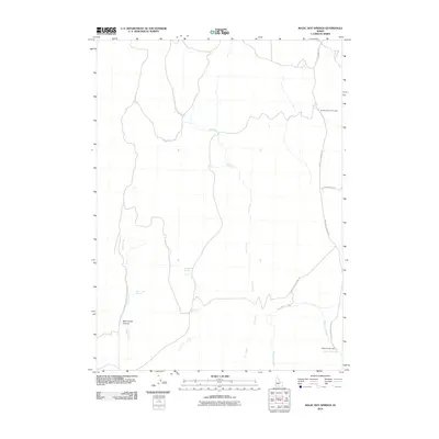
2010 Map of Magic Hot Springs
USGS Topo · Published 2010About this map
Magic Hot Springs serves as the focal point for this landscape in southern Idaho, situated along the southern reaches of Shoshone Creek. This area is characterized by a high-desert hydrological network defined by numerous seasonal and perennial water sources, including the isolated Rock Cabin Spring and Rattlesnake Springs in the central flats. The topography is deeply incised by Mule Creek as it passes through Mule Creek Canyon, while the northeastern corner provides public access via the Winter Spring Picnic Area. Sparse transportation routes, such as Magic Hot Springs Rd and the Basin Cutoff Rd, connect these remote features, reflecting the traditional reliance on the region's scattered springs and creek beds for transit and recreation in Twin Falls County.
Find a feature on this map
13 named features on this map. Tap any name to fly to it.
Don’t see what you’re looking for? This feature index may not catch every label — zoom into the map to look around manually.
Map Details
Editions of this 2010 Magic Hot Springs Map
This is the sole edition of this map. No revisions or reprints were ever made.
Other maps of this area

1955 · Twin Falls
USGS Topo · 1:250,000

1955 · Wells
USGS Topo · 1:250,000

1957 · Delaplain
USGS Topo · 1:62,500

1958 · Wells
USGS Topo · 1:250,000

1958 · Twin Falls
USGS Topo · 1:250,000

1961 · Wells
USGS Topo · 1:250,000

1961 · Gollaher Mountain
USGS Topo · 1:62,500

1977 · Big Creek Ranch
USGS Topo · 1:24,000

1977 · Rogerson
USGS Topo · 1:24,000

1977 · Magic Hot Springs
USGS Topo · 1:24,000