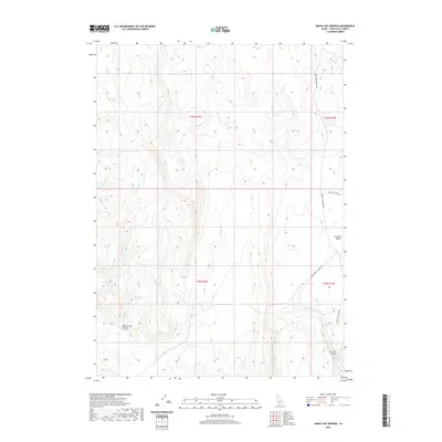
2020 Map of Magic Hot Springs
USGS Topo · Published 2020About this map
Magic Hot Springs serves as a focal point in this remote corner of southern Idaho, where geothermal activity and seasonal water sources dictate the character of the landscape. The terrain is defined by deep incisions such as Mule Creek Canyon and the broad Shoshone Basin, providing a stark contrast between high plateaus and drainage networks. The presence of numerous isolated water sources, including Rattlesnake Springs, Rock Cabin Spring, and Mule Creek Springs, suggests a long history of use by travelers and livestock in an otherwise arid environment. Navigation across this high-desert region relies on a sparse network of tracks like the Mule Creek - Jackpot Rd and Basin Cut-Off Rd, which connect the thermal waters to the surrounding range. The map captures the specialized hydrology of the region, from the seasonal flow of Lost Cr to the eponymous hot springs near Shoshone Cr.
Find a feature on this map
18 named features on this map. Tap any name to fly to it.
Don’t see what you’re looking for? This feature index may not catch every label — zoom into the map to look around manually.
Map Details
Editions of this 2020 Magic Hot Springs Map
This is the sole edition of this map. No revisions or reprints were ever made.
Other maps of this area

1955 · Twin Falls
USGS Topo · 1:250,000

1955 · Wells
USGS Topo · 1:250,000

1957 · Delaplain
USGS Topo · 1:62,500

1958 · Wells
USGS Topo · 1:250,000

1958 · Twin Falls
USGS Topo · 1:250,000

1961 · Wells
USGS Topo · 1:250,000

1961 · Gollaher Mountain
USGS Topo · 1:62,500

1977 · Big Creek Ranch
USGS Topo · 1:24,000

1977 · Rogerson
USGS Topo · 1:24,000

1977 · Magic Hot Springs
USGS Topo · 1:24,000