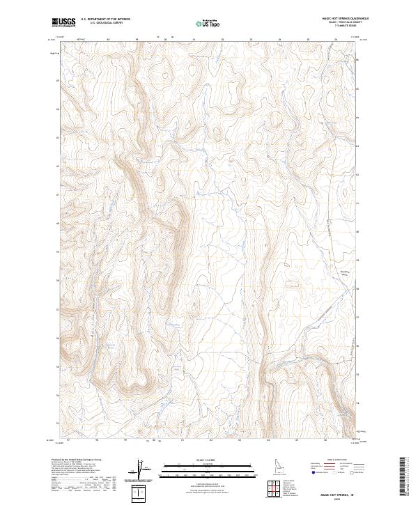
2023 Map of Magic Hot Springs
USGS Topo · Published 2023About this map
Magic Hot Springs anchors the southeastern corner of this Twin Falls County landscape, where the high desert meets a complex network of seasonal water sources. The map reveals a land defined by its hydrology, centered on the drainage of Lost Creek and the notable Shoshone Basin to the east. The terrain is deeply inscribed by Mule Creek Canyon and numerous essential water points that historically sustained movement through this region, including Rattlesnake Springs, Rock Cabin Spring, and Winter Spring. The infrastructure remains sparse, dominated by the Magic Hot Springs Rd and the Mule Creek - Jackpot Rd, which provide the primary access through this high-elevation Idaho backcountry. These routes follow the natural contours of the land, connecting the various springs and creek beds that have long dictated the rhythm of life and travel in this corner of the state.
Find a feature on this map
16 named features on this map. Tap any name to fly to it.
Don’t see what you’re looking for? This feature index may not catch every label — zoom into the map to look around manually.
Map Details
Editions of this 2023 Magic Hot Springs Map
This is the sole edition of this map. No revisions or reprints were ever made.
Other maps of this area

1955 · Twin Falls
USGS Topo · 1:250,000

1955 · Wells
USGS Topo · 1:250,000

1957 · Delaplain
USGS Topo · 1:62,500

1958 · Wells
USGS Topo · 1:250,000

1958 · Twin Falls
USGS Topo · 1:250,000

1961 · Wells
USGS Topo · 1:250,000

1961 · Gollaher Mountain
USGS Topo · 1:62,500

1977 · Big Creek Ranch
USGS Topo · 1:24,000

1977 · Rogerson
USGS Topo · 1:24,000

1977 · Magic Hot Springs
USGS Topo · 1:24,000