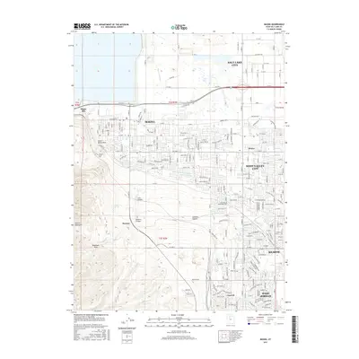
2017 Map of Magna
USGS Topo · Published 2017About this map
Magna and the northern reaches of the Oquirrh Mountains define this industrial and residential landscape on the western edge of the Salt Lake Valley. The map documents the heavy industrial footprint of the Magna Mill and the specialized settlement of Bacchus, historically tied to the explosives industry, positioned near the mouth of Coon Canyon. The transition from the rugged slopes of Harkers Canyon and Limekiln Canyon to the structured grid of West Valley City and Kearns is marked by an extensive network of waterways, including the Utah and Salt Lake Canal and Riter Canal. These canals represent the critical irrigation infrastructure that enabled the expansion of Hunter and other communities across this high desert terrain. Local history is further anchored by the Pleasant Green Cem, serving the area's earliest established neighborhoods.
Find a feature on this map
68 named features on this map. Tap any name to fly to it.
Don’t see what you’re looking for? This feature index may not catch every label — zoom into the map to look around manually.
Map Details
Editions of this 2017 Magna Map
This is the sole edition of this map. No revisions or reprints were ever made.
Other maps of this area

1885 · Salt Lake
USGS Topo · 1:250,000

1885 · Tooele Valley
USGS Topo · 1:250,000

1925 · Ft. Douglas
USGS Topo · 1:125,000

1928 · Ft. Douglas
USGS Topo · 1:125,000

1951 · Saltair
USGS Topo · 1:24,000

1951 · Salt Lake City South
USGS Topo · 1:24,000

1951 · Midvale
USGS Topo · 1:24,000

1951 · Salt Lake City North
USGS Topo · 1:24,000

1952 · Magna
USGS Topo · 1:24,000

1952 · Bingham Canyon
USGS Topo · 1:24,000