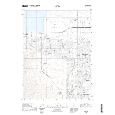
2020 Map of Magna
USGS Topo · Published 2020About this map
Industrial and suburban development define this Salt Lake Valley landscape as it appeared in 2020. The Magna Mill stands as a prominent landmark near the northwestern corner, situated at the base of the Oquirrh Mountains. This transition from the steep terrain of Coon Canyon and Harkers Canyon to the residential grids of Magna and West Valley City reveals the complex water management of the region. A network of man-made waterways, including the Utah and Salt Lake Canal, Riter Canal, and Kersey Cr Canal, crisscrosses the valley floor, supporting the expansion of communities like Hunter and Kearns. To the south, the settlement of Bacchus is positioned near the mouths of the canyons, while Pleasant Green Cem provides a point of genealogical interest for local history researchers.
Find a feature on this map
177 named features on this map. Tap any name to fly to it.
Don’t see what you’re looking for? This feature index may not catch every label — zoom into the map to look around manually.
Map Details
Editions of this 2020 Magna Map
This is the sole edition of this map. No revisions or reprints were ever made.
Other maps of this area

1885 · Salt Lake
USGS Topo · 1:250,000

1885 · Tooele Valley
USGS Topo · 1:250,000

1925 · Ft. Douglas
USGS Topo · 1:125,000

1928 · Ft. Douglas
USGS Topo · 1:125,000

1951 · Saltair
USGS Topo · 1:24,000

1951 · Salt Lake City South
USGS Topo · 1:24,000

1951 · Midvale
USGS Topo · 1:24,000

1951 · Salt Lake City North
USGS Topo · 1:24,000

1952 · Magna
USGS Topo · 1:24,000

1952 · Bingham Canyon
USGS Topo · 1:24,000