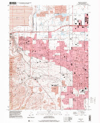
1999 Map of Magna
USGS Topo · Published 2001About this map
The industrial and residential growth of the Salt Lake Valley is clearly visible in this survey, particularly where the Oquirrh Mountains meet the valley floor. Dominating the northwest corner is the massive Magna Mill and its adjacent Tailings Pond, marking the significant mineral processing history of Magna. The map reveals a transition from these industrial zones and the canyons like Coon Canyon to the suburban expansion of Hunter and West Valley City.
Find a feature on this map
57 named features on this map. Tap any name to fly to it.
Don’t see what you’re looking for? This feature index may not catch every label — zoom into the map to look around manually.
Map Details
Editions of this 1999 Magna Map
This is the sole edition of this map. No revisions or reprints were ever made.
Other maps of this area

1885 · Salt Lake
USGS Topo · 1:250,000

1885 · Tooele Valley
USGS Topo · 1:250,000

1925 · Ft. Douglas
USGS Topo · 1:125,000

1928 · Ft. Douglas
USGS Topo · 1:125,000

1951 · Saltair
USGS Topo · 1:24,000

1951 · Salt Lake City South
USGS Topo · 1:24,000

1951 · Midvale
USGS Topo · 1:24,000

1951 · Salt Lake City North
USGS Topo · 1:24,000

1952 · Magna
USGS Topo · 1:24,000

1952 · Bingham Canyon
USGS Topo · 1:24,000