2023 Map of Mahaffey
USGS Topo · Published 2023About this map
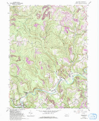
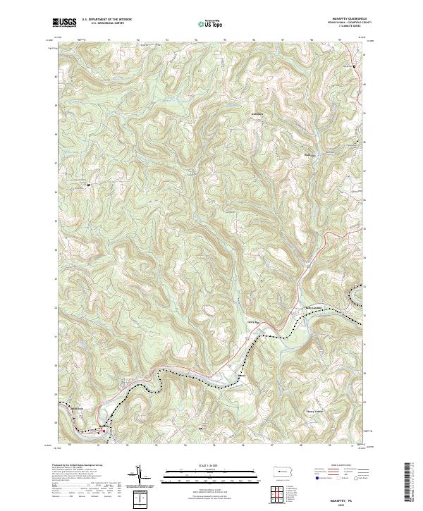
The West Branch Susquehanna River winds through this section of Clearfield County, anchoring a series of small settlements that reflect the region's historic dependence on the water and rail corridors. Community life is centered around Mahaffey, Bells Landing, and Curry Run, while the surrounding hills are marked by numerous family and community burial grounds including Sabin Cem, Banner Ridge Cem, and Woods Cem. The landscape is deeply incised by a network of drainage ways such as Beech Run, Irish Run, and Haslett Run, which define the narrow valleys where roads like Kings Hwy and Walltown Rd connect isolated homesteads to the river towns. Notable elevation changes are visible at Redden Hill, where the terrain rises sharply from the riverbanks. This modern survey preserves the locations of many local landmarks, from the Saint Bonaventure Cem near Walltown to the rural crossroads of Cherry Corner and Irishtown.
Find a feature on this map
61 named features on this map. Tap any name to fly to it.
Don’t see what you’re looking for? This feature index may not catch every label — zoom into the map to look around manually.
Map Details
Editions of this 2023 Mahaffey Map
This is the sole edition of this map. No revisions or reprints were ever made.