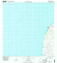
1995 Map of Mahukona
USGS Topo · Published 1998About this map
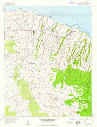
Mahukona Harbor serves as the focal point for this coastal survey of Hawaii's northwestern shore, where the land meets the deep waters of the Alenuihaha Channel. The landscape is a corridor of historical significance, home to the Kahola Historical Sites State Monument and several former settlement locations identified as Honoipu Landing (Site) and Haena (Site). The shoreline is deeply etched with small inlets like Umiwai Bay and Holana Bay, reflecting a maritime-dependent history that transitioned into modern utility and conservation. Inland, the terrain is marked by land divisions or landmarks such as Upolu, Honoipu, and Kapaanui. Infrastructure for the era includes the Upolu Point Loran Station Coast Guard Res and various radio facilities and water tanks, indicating the region's role in mid-century navigation and coastal defense.
Find a feature on this map
41 named features on this map. Tap any name to fly to it.
Don’t see what you’re looking for? This feature index may not catch every label — zoom into the map to look around manually.
Map Details
Editions of this 1995 Mahukona Map
This is the sole edition of this map. No revisions or reprints were ever made.
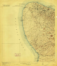
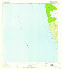
Other maps of this area

1913 · Kohala
USGS Topo · 1:62,500
1916 · Kohala
USGS Topo · 1:62,500

1954 · Hawaii North
USGS Topo · 1:250,000
1957 · Keawanui Bay
USGS Topo · 1:24,000
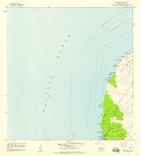
1957 · Mahukona
USGS Topo · 1:24,000
1957 · Hawi
USGS Topo · 1:24,000

1959 · Hawaii North
USGS Topo · 1:250,000

1961 · Hawaii North
USGS Topo · 1:250,000

1975 · Hawaii
USGS Topo · 1:250,000

1980 · Hawaii County Sheet 1
USGS Topo · 1:100,000