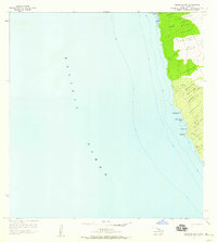
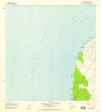
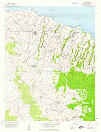
1957 Map of Keawanui Bay
USGS Topo · Published 1959About this map
The coastal landscape of North Kohala on the Island of Hawaii is defined by a series of land divisions reaching from the shoreline to the uplands. This mid-century survey documents the transition from the Pacific Ocean to the rugged slopes of Puukole, highlighting historical land tracts like Lapakahi, Kaipuhaa, and Paoo. Along the shoreline, significant maritime and historical sites are noted, including the Coast Guard Res at Kaoma Pt and numerous ruins that suggest earlier Hawaiian occupation patterns. Coastal indentations such as Keaweula Bay, Keawanui Bay, and Wawuonu Bay provide natural landmarks against the steep topography. Internal movement is represented by a network of Jeep Trails that traverse the ahupuaʻa boundaries, connecting sites like Kaiholena and Makeanehu. The presence of a well and specific elevation markers like Vabm 304 underscore the practical infrastructure of the era.
Find a feature on this map
33 named features on this map. Tap any name to fly to it.
Don’t see what you’re looking for? This feature index may not catch every label — zoom into the map to look around manually.
Map Details
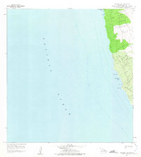
Editions of this 1957 Keawanui Bay Map
2 editions found
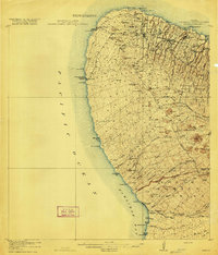
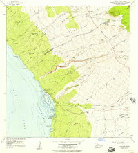
Other maps of this area

1913 · Kohala
USGS Topo · 1:62,500
1916 · Kohala
USGS Topo · 1:62,500

1954 · Hawaii North
USGS Topo · 1:250,000
1956 · Kawaihae
USGS Topo · 1:24,000
1957 · Mahukona
USGS Topo · 1:24,000
1957 · Hawi
USGS Topo · 1:24,000

1959 · Hawaii North
USGS Topo · 1:250,000

1961 · Hawaii North
USGS Topo · 1:250,000

1975 · Hawaii
USGS Topo · 1:250,000

1980 · Hawaii County Sheet 1
USGS Topo · 1:100,000