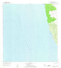
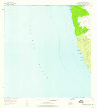
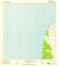
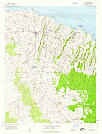
1957 Map of Keawanui Bay
USGS Topo · Published 1975About this map
The leeward Kohala coast of Hawaii's Big Island is documented here following a mid-1950s field check, showing a landscape defined by traditional land divisions and modern maritime infrastructure. The shoreline is punctuated by several prominent inlets, including Keaweula Bay, Keawanui Bay, and Wawuionu Bay, while the northern edge of the survey marks the Coast Guard Res. at Kaoma Pt.
Find a feature on this map
35 named features on this map. Tap any name to fly to it.
Don’t see what you’re looking for? This feature index may not catch every label — zoom into the map to look around manually.
Map Details
Editions of this 1957 Keawanui Bay Map
2 editions found
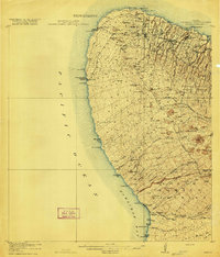
Other maps of this area

1913 · Kohala
USGS Topo · 1:62,500
1916 · Kohala
USGS Topo · 1:62,500

1954 · Hawaii North
USGS Topo · 1:250,000
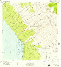
1956 · Kawaihae
USGS Topo · 1:24,000
1957 · Keawanui Bay
USGS Topo · 1:24,000
1957 · Mahukona
USGS Topo · 1:24,000
1957 · Hawi
USGS Topo · 1:24,000

1959 · Hawaii North
USGS Topo · 1:250,000

1961 · Hawaii North
USGS Topo · 1:250,000

1975 · Hawaii
USGS Topo · 1:250,000