
1956 Map of Kawaihae
USGS Topo · Published 1957About this map
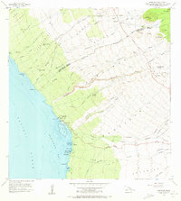
Puukohola Heiau stands as a prominent cultural landmark on the shores of Kawaihae Bay, marking a coastal landscape defined by ancient sites and mid-century maritime infrastructure. This 1956 field survey captures the transition of the Kohala coastline, showing the established Kawaihae settlement alongside its Kawaihae Pier and Coast Guard Reservation. The map documents numerous land divisions such as Kahua, Waika, and Lalamilo, which stretch from the volcanic cinder cones of the interior down to the coral reefs of the Pacific. Inland, the topography is carved by a series of steep drainages including Honokoa Gulch and Luahine Gulch, while former habitation areas like Hoepa (Site) and Kawaihae Uka (Site) indicate shifting settlement patterns. From the Kohala Forest Reserve heights down to the sands of Waikui Beach, the map provides a precise record of the district boundary between the North Kohala District and South Kohala District.
Find a feature on this map
69 named features on this map. Tap any name to fly to it.
Don’t see what you’re looking for? This feature index may not catch every label — zoom into the map to look around manually.
Map Details
Editions of this 1956 Kawaihae Map
2 editions found
Other maps of this area

1913 · Kohala
USGS Topo · 1:62,500

1916 · Kohala
USGS Topo · 1:62,500

1916 · Waipio
USGS Topo · 1:62,500

1928 · Puako
USGS Topo · 1:62,500

1954 · Hawaii North
USGS Topo · 1:250,000

1956 · Puu Hinai
USGS Topo · 1:24,000

1956 · Kamuela
USGS Topo · 1:24,000

1956 · Nohonaohae
USGS Topo · 1:24,000
1957 · Keawanui Bay
USGS Topo · 1:24,000
1957 · Honokane
USGS Topo · 1:24,000