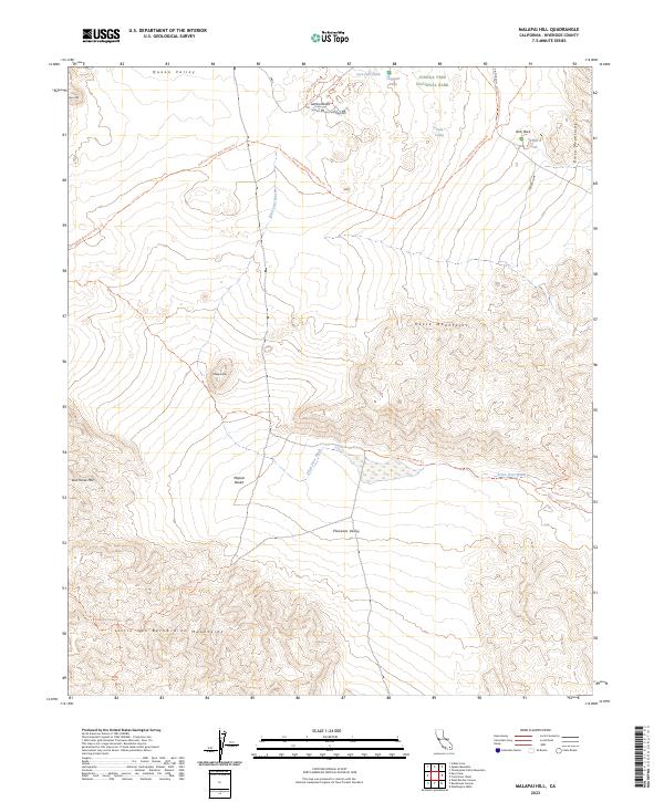
2023 Map of Malapai Hill
USGS Topo · Published 2023About this map
Joshua Tree National Park spans the high desert landscape of this 2023 survey, centered on the volcanic landmark of Malapai Hill. The area represents a crossroads of desert geography, where the Hexie Mountains and the Little San Bernardino Mountains frame the arid basins of Queen Valley and Pleasant Valley. A network of historic paths and modern recreational routes, including the California Riding And Hiking Trl and the Hexahedron Mine Trl, traces the movement of early prospectors and travelers through the Mojave Desert. Water sources are critical identifiers in this environment, marked by sites such as White Tank, Twin Tanks, and the seasonal drainage of Fried Liver Wash. These features, along with the distinctive formations at Jumbo Rocks and Arch Rock, provide essential context for understanding the transition from mining-era exploration to modern conservation.
Find a feature on this map
26 named features on this map. Tap any name to fly to it.
Don’t see what you’re looking for? This feature index may not catch every label — zoom into the map to look around manually.
Map Details
Editions of this 2023 Malapai Hill Map
This is the sole edition of this map. No revisions or reprints were ever made.
Other maps of this area

1942 · Amboy
USGS Topo · 1:250,000

1943 · Amboy
USGS Topo · 1:250,000

1943 · Pinkham Well
USGS Topo · 1:62,500

1944 · Pinkham Well
USGS Topo · 1:62,500

1944 · Pinyon Well
USGS Topo · 1:62,500

1947 · Santa Ana
USGS Topo · 1:250,000

1949 · Santa Ana
USGS Topo · 1:250,000

1953 · San Bernardino
USGS Topo · 1:250,000

1954 · Salton Sea
USGS Topo · 1:250,000

1954 · Needles
USGS Topo · 1:250,000