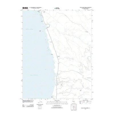
2012 Map of Mallo Pass Creek
USGS Topo · Published 2012About this map
The San Andreas Fault runs just offshore of this Mendocino County coastline, where the rugged Pacific edge meets a series of agricultural holdings and residential developments. Coastal landmarks like Gunderson Rock and White Rock define the shoreline near Bridgeport Landing, a point of historical interest for maritime history and local commerce. Further inland, the map shows the transition from shoreline ranching at Galletti Ranch and Christiansen Ranch to the more structured roads of Pomo Lake Dr and Hill Crest Dr. The landscape is deeply incised by numerous waterways including Mallo Pass Cr, Irish Cr, and Mills Cr, which flow from high points like Bald Hill and the prominent Cliff Ridge. These drainages, along with features such as Irish Gulch and Cowshed Gulch, illustrate the complex drainage patterns of this coastal shelf.
Find a feature on this map
25 named features on this map. Tap any name to fly to it.
Don’t see what you’re looking for? This feature index may not catch every label — zoom into the map to look around manually.
Map Details
Editions of this 2012 Mallo Pass Creek Map
This is the sole edition of this map. No revisions or reprints were ever made.
Other maps of this area

1943 · Point Arena
USGS Topo · 1:62,500

1943 · Albion
USGS Topo · 1:62,500

1943 · Navarro
USGS Topo · 1:62,500

1944 · Saddle Point
USGS Topo · 1:62,500

1947 · Santa Rosa
USGS Topo · 1:250,000

1949 · Santa Rosa
USGS Topo · 1:250,000

1957 · Ukiah
USGS Topo · 1:250,000

1958 · Santa Rosa
USGS Topo · 1:250,000

1960 · Ukiah
USGS Topo · 1:250,000
1960 · Elk
USGS Topo · 1:24,000