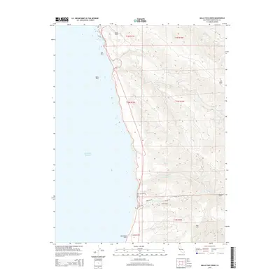
2015 Map of Mallo Pass Creek
USGS Topo · Published 2015About this map
The San Andreas Fault runs just offshore of this Mendocino County coastline, where the rugged maritime landscape meets the residential development at Irish Beach. The road network, including Irish Beach Dr and Alta Mesa Rd, winds through the elevation gains of Irish Gulch and Cowshed Gulch, reflecting the region's late-twentieth-century shift toward coastal community planning. These residential enclaves are defined by their proximity to significant watercourses like Mallo Pass Creek and Irish Cr, which drain the uplifted terrain of Cliff Ridge and Bald Hill into the Pacific Ocean. Numerous rocky landmarks such as Elk Rock and White Rock dot the shoreline, marking a coastline shaped by intense geological activity. This survey captures the transition from the steep, forested drainages of Greenwood Cr and Elk Cr to the structured street layouts of the south, illustrating the balance between wilderness and development.
Find a feature on this map
26 named features on this map. Tap any name to fly to it.
Don’t see what you’re looking for? This feature index may not catch every label — zoom into the map to look around manually.
Map Details
Editions of this 2015 Mallo Pass Creek Map
This is the sole edition of this map. No revisions or reprints were ever made.
Other maps of this area

1943 · Point Arena
USGS Topo · 1:62,500

1943 · Albion
USGS Topo · 1:62,500

1943 · Navarro
USGS Topo · 1:62,500

1944 · Saddle Point
USGS Topo · 1:62,500

1947 · Santa Rosa
USGS Topo · 1:250,000

1949 · Santa Rosa
USGS Topo · 1:250,000

1957 · Ukiah
USGS Topo · 1:250,000

1958 · Santa Rosa
USGS Topo · 1:250,000

1960 · Ukiah
USGS Topo · 1:250,000
1960 · Elk
USGS Topo · 1:24,000