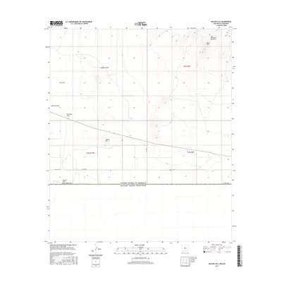
2017 Map of Malpais Hill
USGS Topo · Published 2017About this map
The United States-Mexico international border forms the southern boundary of this high-desert landscape in Luna County. The arid terrain is defined by a series of intermittent drainage systems, including Cox Draw, Simpson Draw, and Hermanas Draw, which channel seasonal water through the Chihuahuan Desert. Significant topographical relief is concentrated in the northeast at Black Top and the Tres Hermanas Mountains, while the prominent volcanic silhouette of Malpais Hill rises in the central portion of the quadrangle. Human land use is sparsely indicated by water management points like Hoppy Tank and Line Ranch Tank, alongside local road networks including the Carzalia Loop and County Road C004. This survey illustrates the geometric precision of the Public Land Survey System as it intersects the older international boundary line.
Find a feature on this map
18 named features on this map. Tap any name to fly to it.
Don’t see what you’re looking for? This feature index may not catch every label — zoom into the map to look around manually.
Map Details
Editions of this 2017 Malpais Hill Map
This is the sole edition of this map. No revisions or reprints were ever made.
Other maps of this area

1917 · Hermanas
USGS Topo · 1:62,500

1917 · Columbus
USGS Topo · 1:62,500

1918 · Columbus
USGS Topo · 1:62,500

1918 · Hermanas
USGS Topo · 1:62,500

1920 · Columbus
USGS Topo · 1:62,500

1943 · Hermanas
USGS Topo · 1:62,500

1953 · El Paso
USGS Topo · 1:250,000

1959 · El Paso
USGS Topo · 1:250,000

1964 · El Paso
USGS Topo · 1:250,000
1964 · Hermanas
USGS Topo · 1:24,000