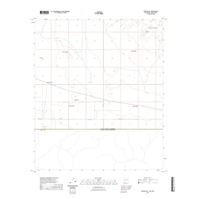
2023 Map of Malpais Hill
USGS Topo · Published 2023About this map
United States Of America Estados Unidos Mexicanos defines the southern boundary of this arid landscape in Luna County, marking the transition between New Mexico and Mexico. The terrain is characterized by volcanic and alluvial formations, most notably the southern reaches of the Tres Hermanas Mountains including the prominent Black Top. Water management in this high desert environment is evidenced by features such as Hoppy Tank and Line Ranch Tank, which are critical for the cattle ranching that persists in the region. The map also traces a series of ephemeral drainage paths like Cox Draw, Hermanas Draw, and Simpson Draw. Modern infrastructure is limited to rural thoroughfares like Carzalia Loop and Co Rd C004, providing access across the volcanic slopes of Malpais Hill.
Find a feature on this map
16 named features on this map. Tap any name to fly to it.
Don’t see what you’re looking for? This feature index may not catch every label — zoom into the map to look around manually.
Map Details
Editions of this 2023 Malpais Hill Map
This is the sole edition of this map. No revisions or reprints were ever made.
Other maps of this area

1917 · Hermanas
USGS Topo · 1:62,500

1917 · Columbus
USGS Topo · 1:62,500

1918 · Columbus
USGS Topo · 1:62,500

1918 · Hermanas
USGS Topo · 1:62,500

1920 · Columbus
USGS Topo · 1:62,500

1943 · Hermanas
USGS Topo · 1:62,500

1953 · El Paso
USGS Topo · 1:250,000

1959 · El Paso
USGS Topo · 1:250,000

1964 · El Paso
USGS Topo · 1:250,000
1964 · Hermanas
USGS Topo · 1:24,000