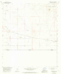
1965 Map of Malpais Hill
USGS Topo · Published 1967About this map
Tres Hermanas Mountains dominate the northeastern corner of this Chihuahuan Desert landscape, with peaks such as Black Top rising sharply above the alluvial plains. This mid-1960s survey captures a sparse ranching and transit corridor along the international border between the United States and Mexico. Human activity is centered on a handful of isolated outposts like Dogtown Ranch, Edwards Ranch, and Line Ranch, all dependent on scattered water sources such as Simpson Well and Hoppy Tank.
Find a feature on this map
22 named features on this map. Tap any name to fly to it.
Don’t see what you’re looking for? This feature index may not catch every label — zoom into the map to look around manually.
Map Details
Editions of this 1965 Malpais Hill Map
This is the sole edition of this map. No revisions or reprints were ever made.
Other maps of this area

1917 · Hermanas
USGS Topo · 1:62,500

1917 · Columbus
USGS Topo · 1:62,500

1918 · Columbus
USGS Topo · 1:62,500

1918 · Hermanas
USGS Topo · 1:62,500

1920 · Columbus
USGS Topo · 1:62,500

1943 · Hermanas
USGS Topo · 1:62,500

1953 · El Paso
USGS Topo · 1:250,000

1959 · El Paso
USGS Topo · 1:250,000

1964 · El Paso
USGS Topo · 1:250,000
1964 · Hermanas
USGS Topo · 1:24,000