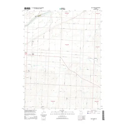
2015 Map of Malta Bend
USGS Topo · Published 2015About this map
The Missouri River curves along the northern boundary of this Saline County landscape, where the community of Malta Bend serves as a primary local hub. The terrain is defined by a dense network of tributaries including Salt Fork, Bear Cr, and Muddy Cr that carve through the agricultural fields of the mid-2010s. This survey is particularly useful for genealogists, as it documents several historical burial sites distributed across the township, such as Little Grove Cemetery, Malta Bend Cemetery, and Saint Marys Cemetery.
Find a feature on this map
58 named features on this map. Tap any name to fly to it.
Don’t see what you’re looking for? This feature index may not catch every label — zoom into the map to look around manually.
Map Details
Editions of this 2015 Malta Bend Map
This is the sole edition of this map. No revisions or reprints were ever made.
Other maps of this area

1890 · Marshall
USGS Topo · 1:125,000

1892 · Marshall
USGS Topo · 1:125,000

1901 · Marshall
USGS Topo · 1:125,000

1940 · Marshall
USGS Topo · 1:62,500

1944 · Marshall
USGS Topo · 1:62,500

1951 · Miami
USGS Topo · 1:24,000

1951 · Miami Station
USGS Topo · 1:24,000

1951 · Carrollton East
USGS Topo · 1:24,000

1953 · Moberly
USGS Topo · 1:250,000
1953 · Blackburn
USGS Topo · 1:24,000