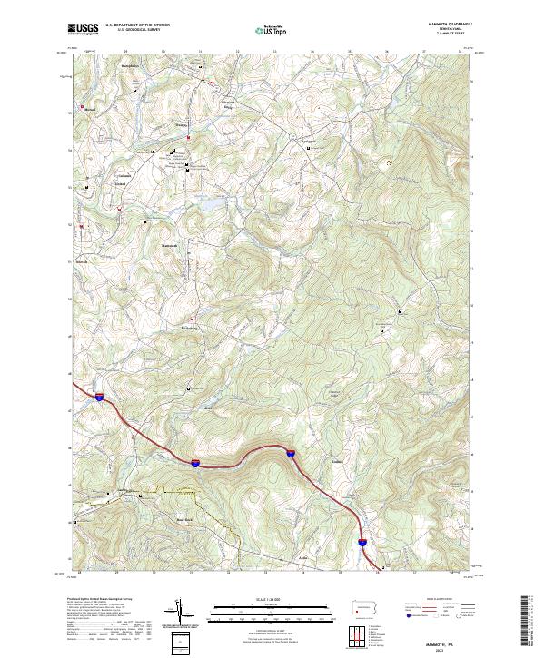
2023 Map of Mammoth
USGS Topo · Published 2023About this map
Mammoth and its surrounding coal-country settlements in Westmoreland and Fayette counties appear here as they exist in the early 2020s. This region is characterized by a dense network of small villages including Trauger, Calumet, United, and Kecksburg, many of which developed around the local mining industry. The map captures a high density of burial sites with genealogical significance, ranging from denominational grounds like Saint Mary's Byzantine Catholic Cem and Saint Stanislaus Cem to smaller family markers like Brothers Cem and the Byerly Freeman Cem near Rodney. Drainage patterns are defined by the Sewickley Creek watershed and Loyalhanna Lake in the north, while the southern terrain rises sharply toward Chestnut Ridge. Transportation routes such as Moccasin Hollow Rd and Hunter Hill Rd navigate the valley floors beneath Ankney Hill and Ankney Hill.
Find a feature on this map
80 named features on this map. Tap any name to fly to it.
Don’t see what you’re looking for? This feature index may not catch every label — zoom into the map to look around manually.
Map Details
Editions of this 2023 Mammoth Map
This is the sole edition of this map. No revisions or reprints were ever made.
Other maps of this area

1900 · Latrobe
USGS Topo · 1:62,500

1902 · Latrobe
USGS Topo · 1:62,500

1902 · Connellsville
USGS Topo · 1:62,500

1903 · Latrobe
USGS Topo · 1:62,500

1904 · Greensburg
USGS Topo · 1:62,500

1906 · Greensburg
USGS Topo · 1:62,500

1922 · Donegal
USGS Topo · 1:62,500

1931 · Connellsville
USGS Topo · 1:62,500

1935 · Donegal
USGS Topo · 1:62,500

1936 · Connellsville
USGS Topo · 1:62,500
Featured Places
- Donegal Township, PA
- Mount Pleasant Township, PA
- Laurelville, Bullskin Township
- Lycippus, Unity Township
- Mutual, Unity Township