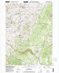
1997 Map of Mammoth
USGS Topo · Published 2000About this map
The ridge-and-valley landscape of Westmoreland and Fayette counties is defined here by a long history of industrial extraction and deep-rooted Catholic parishes. Mammoth County Park centers the quadrangle, bordering the waters of Mammoth Lake, while the surrounding terrain is heavily marked by the coal industry, featuring numerous Strip Mines and the Brinker Reclaimed Strip Mine. The settlement pattern reflects the patch towns of the Pennsylvania coal fields, with communities like United, Calumet, and Norvelt serving as centers of local life.
Find a feature on this map
61 named features on this map. Tap any name to fly to it.
Don’t see what you’re looking for? This feature index may not catch every label — zoom into the map to look around manually.
Map Details
Editions of this 1997 Mammoth Map
This is the sole edition of this map. No revisions or reprints were ever made.
Other maps of this area

1900 · Latrobe
USGS Topo · 1:62,500

1902 · Latrobe
USGS Topo · 1:62,500

1902 · Connellsville
USGS Topo · 1:62,500

1903 · Latrobe
USGS Topo · 1:62,500

1904 · Greensburg
USGS Topo · 1:62,500

1906 · Greensburg
USGS Topo · 1:62,500

1922 · Donegal
USGS Topo · 1:62,500

1931 · Connellsville
USGS Topo · 1:62,500

1935 · Donegal
USGS Topo · 1:62,500

1936 · Connellsville
USGS Topo · 1:62,500
Featured Places
- Bullskin Township, PA
- Mount Pleasant Township, PA
- Mammoth, Mount Pleasant Township
- Lycippus, Unity Township
- Trauger, Mount Pleasant Township